Diving Sipadan Island

In 1998, while living in Singapore, I spent 7 days diving Sipadan Island off the east coast of Sabah – it was, by far and away, the best diving experience of my life.
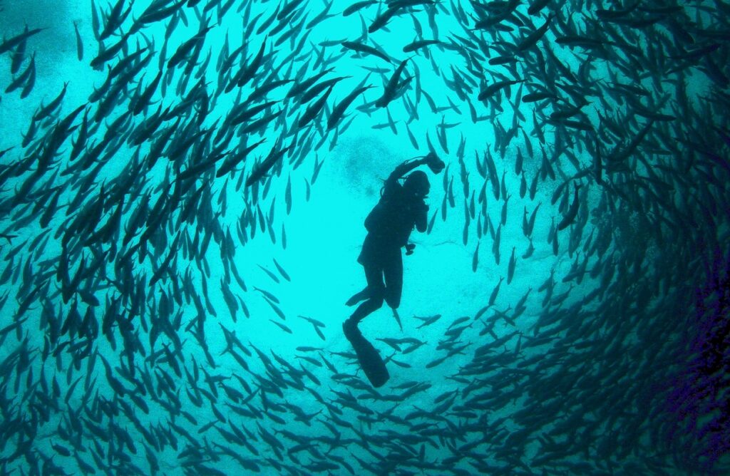
A scuba diver swims in the middle of a school of Jet fish at Sipadan.

Located in the Celebes Sea, off the east coast of Sabah, Sipadan is the only oceanic island in Malaysia. It rises almost vertically 600 metres (2,000 ft) from the seabed providing extraordinary wall-dives in a marine paradise.

Sipadan is located in one of the world’s richest marine environments. Referred to as the Big Fish capital of the world featuring barracudas, large schools of jacks and bumphead parrotfish and an abundance of green turtles. Most of the diving in Sipadan is a combination of wall and drift diving. The walls are covered with hard corals, soft corals, gorgonians and sponges.

It is hard to choose between the amazing dives I managed during my week long stay on the island:

Barracudas

Swimming away from the wall we went in search of a school of barracudas. Aggressive when swimming alone, barracudas are not dangerous when they school in their thousands in hollow cones often more than twenty metres high. We found a school almost immediately and our divemaster guided us into the centre of the school. We remained surrounded by the school for the next twenty minutes – a magical experience.
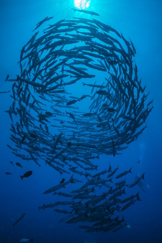
Barracudas are not dangerous when they school

Giant Parrot Fish

Weighing over 80kg and more than 1 metre long, thousands of enormous bumphead parrotfish graze on the corals along the vertical wall for algae. They were not bothered by us so it was possible to get close enough to touch them – at night under torch light the were luminescent. And below at 40+ metres we sighted hammerhead sharks circling.
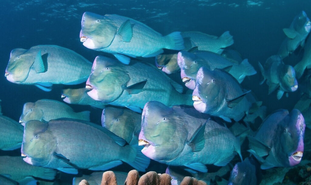
Bumphead Parrotfish weigh over 80kg and are more than 1 metre long. Photo by Erik Schlogl

Green Turtles

I saw more turtles on one dive here than in all my diving anywhere else.
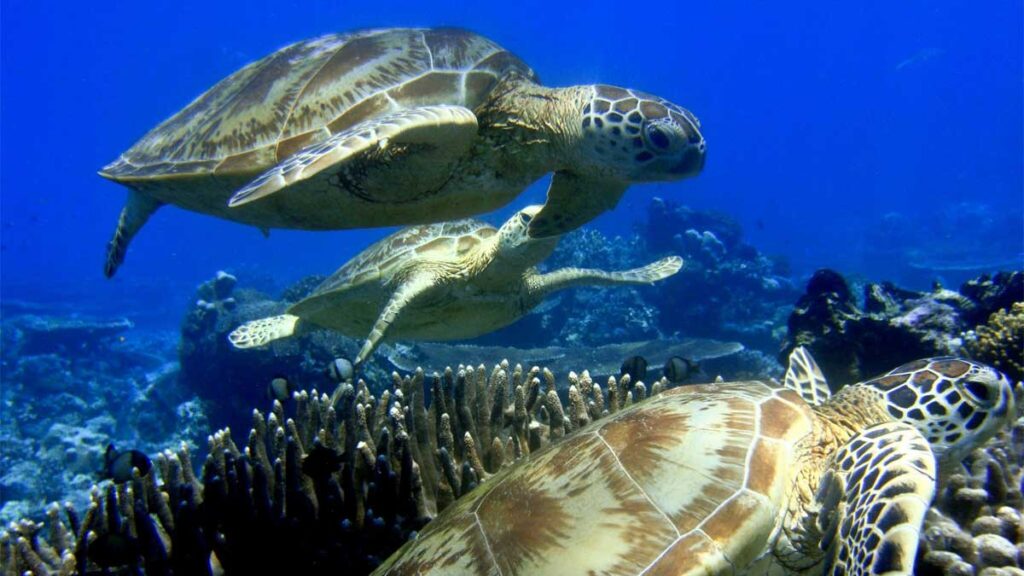
We swan with hundreds of turtles every time we entered the water.

Filipino militant attacks

18 months after my visit 21 people were kidnapped off Sipadan by the Filipino Moro pirate group Abu Sayyaf.

“The armed terrorists arrived by boat, forcing 10 tourists and 11 resort workers to board the vessels at gunpoint, after which they brought the victims to Jolo. All of the victims were eventually released. As a result of the attacks, visitors were no longer allowed to stay on the island resort but have to arrive in dive boats.” (Wikipedia)

Main article: 2000 Sipadan kidnappings

Cathedral Cave in Gozo, Malta

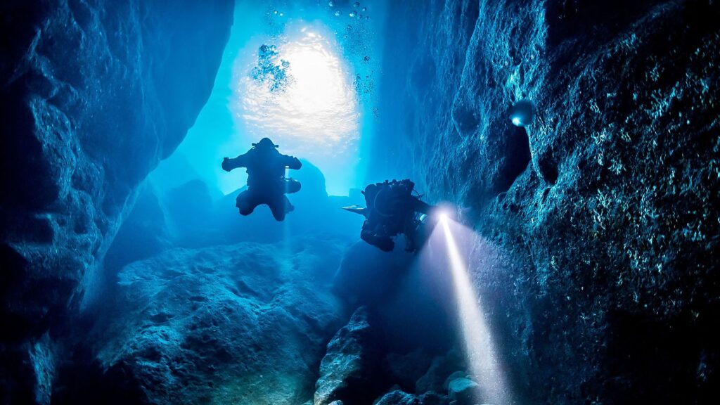
Scuba diving the Cathedral Cave in Gozo, Malta, in 2002 was one of my most extraordinary experiences. I didn’t take this photo but it captures the experience perfectly. Ascending into the cave was like the mystics’ descriptions of entering heaven.

“Accessed from the shores of Ghasri Valley, Cathedral Cave (or Blue Dome) is a huge enclosed dome accessed via a steeply sloping wall located five metres below the surface. Once you enter the dome you can surface to a large air pocket lit up with dancing cobalt reflections by a fissure in the roof.” – https://www.originaldiving.com/blog/gozo-top-dive-sites

The appeal of diving Malta is not so much the sea life, as there isn’t much coral or fish to speak of, but the visibility – often over 50 metres – which is quite extraordinary. The photo above truly represents the visibility to be found in parts of the Mediterranean Sea.

inReach® Mini Marine Bundle:

I always get nervous when weather forecasts via mobile coverage on the water are no longer available – enter the inReach® Mini.

The inReach Mini provides Our Tommy with off the grid interactive SOS and satellite messaging capability and weather forecasting. Using Bluetooth, it pairs with my iPhone/iPad and the free Earthmate navigation app.

Unlike the Iridium GO!, data plans for the inReach Mini are affordable and can be suspended at any time.

Carolyn Shearlock in her excellent blog, The Boat Galley, writes:

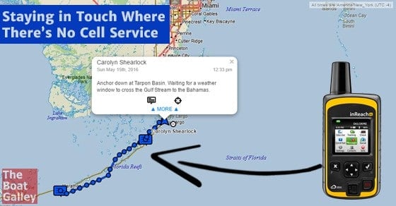
“We love our DeLorme inReach for staying in touch with friends and family via text message to/from any text-enabled phone or an email address, and also being able to share our location via a track link. It works via Iridium satellite service, so there are no dead zones as there are with cell phone coverage…

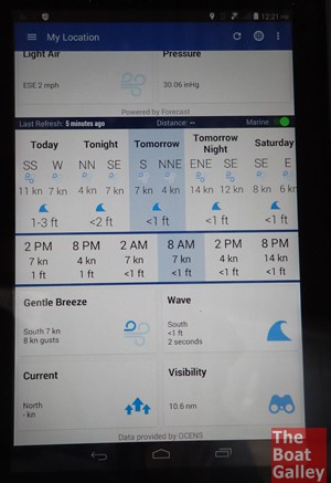
[It] includes the ability to get a weather forecast. While I thought the inReach was fun and useful before, this seriously ups the usefulness factor. Since it uses satellite communications, you can get a forecast virtually anywhere.”

This screenshot shows a Marine forecast on an Android tablet.

Video Review

Location Tracking

The inReach Mini has the ability to track your location. You can log the track by saving it on your inReach, and send the track to your MapShare website page for your friends and family to view.

I’ll be putting our Tommy’s inReach Mini to use early next year when I plan to cruise into Bathurst and Macquarie Harbours where there is no mobile coverage. It would have been very useful early this year in the Kent Group and Flinders Island.

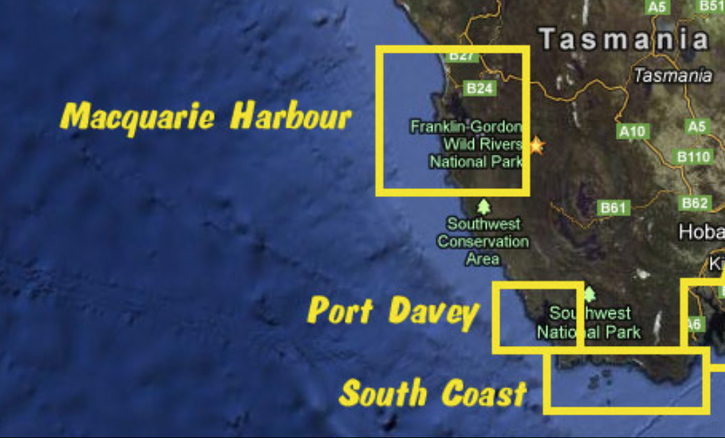
Cruising SW Tasmania plans

image courtesy of Jack and Jude’s Tasmania Anchorages

The solitude of Tasmania’s south-west wilderness coast beckons this summer.

I hope to join the Cruising Yacht club of Tasmania’s cruise in company to Port Davey from 8-20 March 2021. This cruise has been scheduled to coincide with the Frienda of Melaleuca Wildcare working bee.

I have purchased an inReach Mini satellite communicator to stay in touch with family as there is no mobile coverage in most of these locations. This will also provide access to up-to-date weather forecasts as, despite Tas Maritime Radios excellent coverage of the coast, there are black-spots in the VHF network from the entrance of Port Davey to Bathurst Harbour.

Tas Maritime Radios excellent coverage of the coast

Chris Gudgin reports:

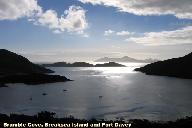
Tasmania Maritime Radio (TMRR) has an extensive VHF/HF radio network with three weather broadcasts daily. Port Davey and Bathurst Harbour are surrounded by mountains, which block VHF as you enter Port Davey all the way to Bathurst Harbour; so all the favourite anchorages, like Brambles Cove, Schooner Cove and Frogs Hollow are in VHF blackout spots.

Once in Bathurst Harbour, however, particularly around Clayton’s Corner, clear two-way VHF was maintained with TMR throughout all weather conditions.

Port Davey and Bathurst Harbour

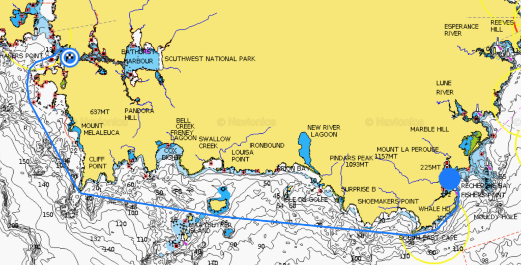
Only a 100 nautical nile, two-day cruise from Kettering via Recherche Bay, the Port Davey/Bathurst Harbour Estuary has “been described as unique, because it is the only large estuary in southern Australia without road access or significant human impact.” Jack and Jude report that “there are numerous anchorages within Bathurst Harbour, which is over 10 miles long. Some are no more than quiet out of the way spots; others offer outings and historical remnants.”
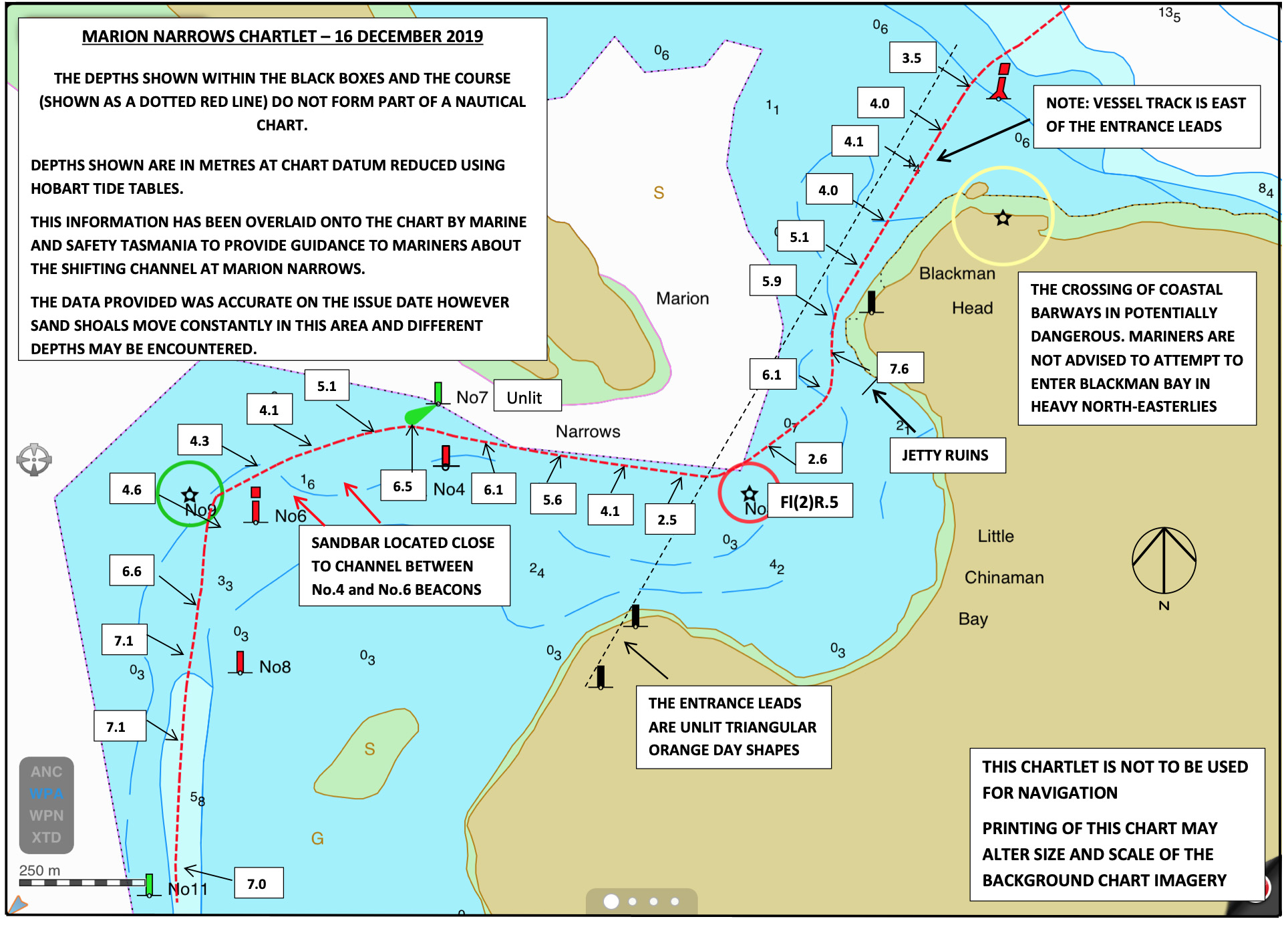
image courtesy of Jack and Jude’s Tasmania Anchorages
Recherche Bay to Schooner Cove in the Bathurst Channel is a 64 nm/14 hour voyage

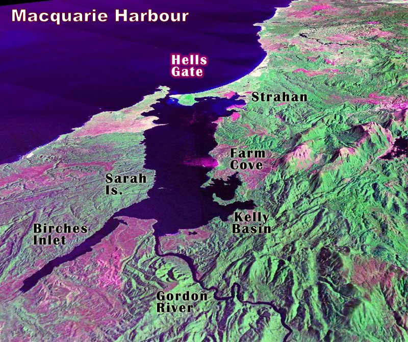
Macquarie Harbour

I won’t make it this far but 85 nautical miles north of Port Davey lies Macquarie Harbour.

Jack and Jude report:

Macquarie Harbour, is the second-largest natural harbour in Australia after Port Phillip Bay. It is six times the size of Sydney Harbour. However, its real glory is not its size, but its setting. The surrounding wilderness and the Gordon River that flows through it are otherworldly. Macquarie Harbour is a superb cruising area offering numerous isolated anchorages.

image courtesy of Jack and Jude’s Tasmania Anchorages

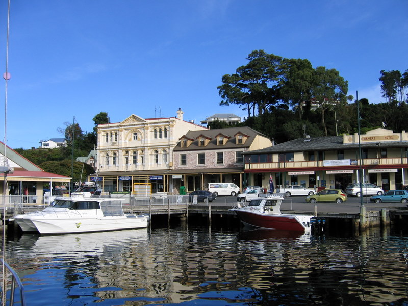
Supplies can be had at Strahan, “a small, picturesque frontier-style town with an abundance of character and a variety of stories to tell of the West Coast’s pioneering days.”

Strahan: image courtesy of Jack and Jude’s Tasmania Anchorages

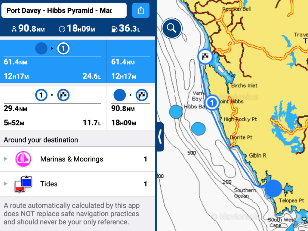
Getting there from Port Davey is a hefty 18+ hour sail but Jack and Jude report an anchorage half way on either side of Point Hibbs with Hibbs Pyramid at the northern end, behind Bird Island at the southern end. This article on mysailing.com.au contains more valuable information about this anchorage and sailing Tasmania’s will west coast.

Port Davey – Macquarie Harbour via overnight at Hibbs Pyramid (weather permitting)

Hastings – Kettering (March 2020)
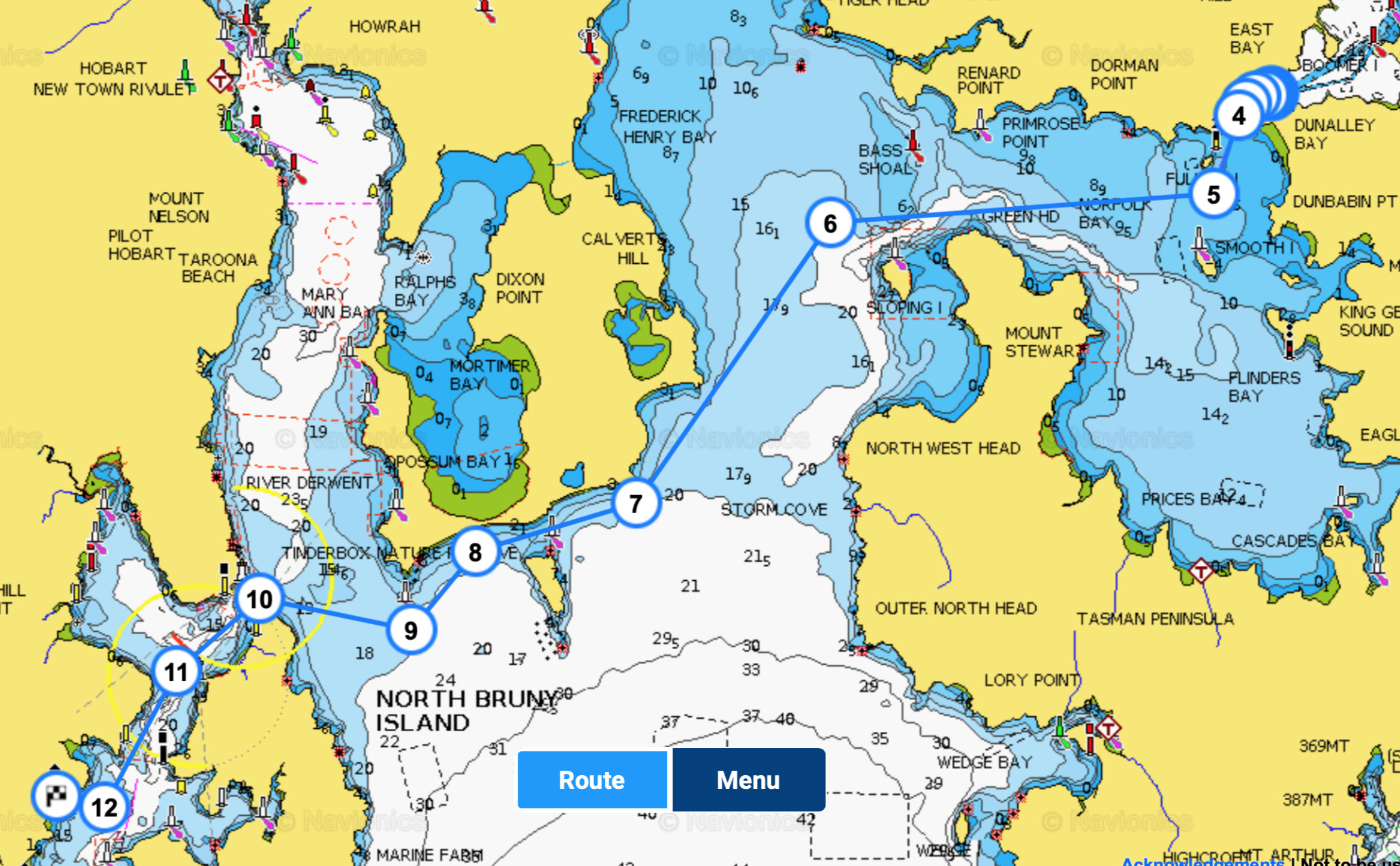
In March 2020 I sailed Our Tommy to Tasmania in search of new sailing grounds. The original plan was to sail north to the Whitsundays but the lure of the southern isle won out; Tasmania is so beautiful! I will stay for a year or so before heading north, hopefully via Tasmania’s rugged and wild western coast.

Click on the headings below to see more information and photos.

Preparation (February 2020)

Yvette and Ludvik, in Australia on a working holiday from the Chech Republic, joined me as crew two weeks prior to departure. They only had six weeks sailing experience in mild conditions in the Mediterranean but both were RYA qualified day skippers and experienced scuba divers. More importantly they were avid adventurers, young and very fit.
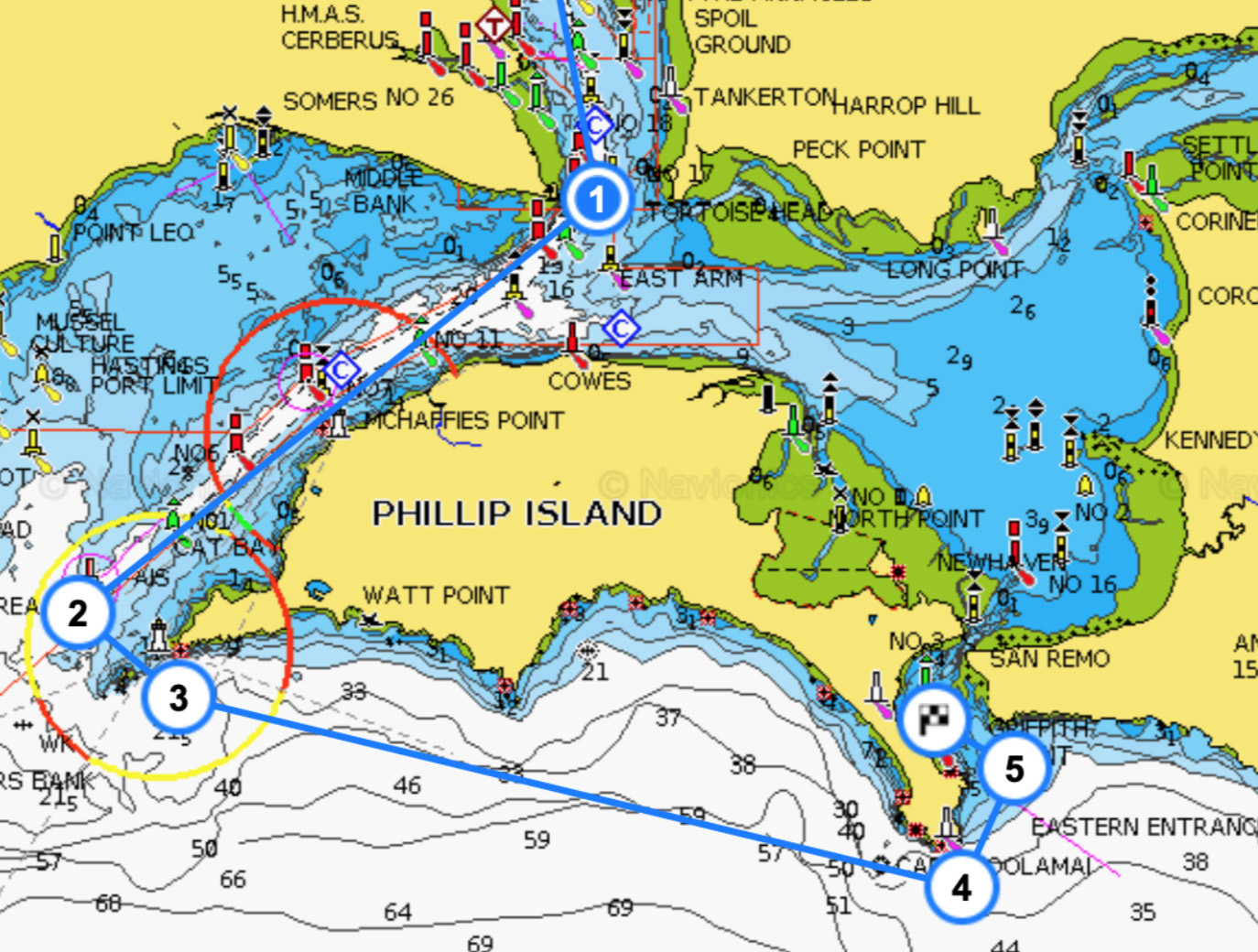
To learn the boat, and experience Bass Straight conditions, we spent 4 days cruising into Port Philip Bay staying at Queenscliff, Mornington & Sorrento before returning to Hastings for final provisioning.

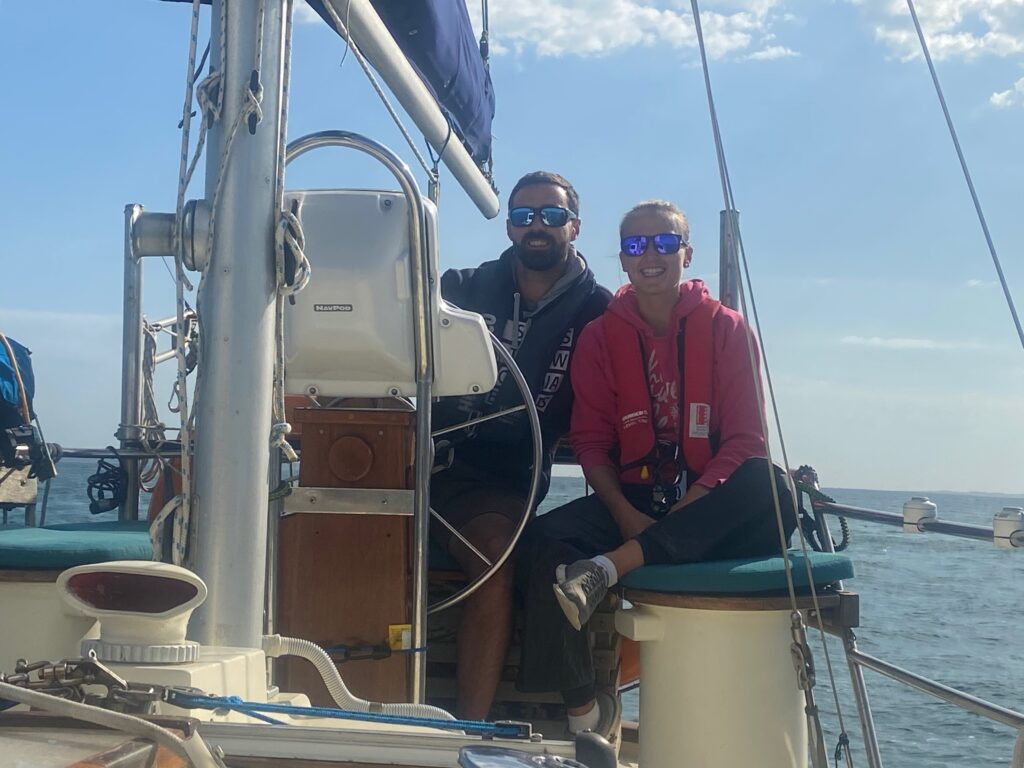
My crew – Yvette and Ludvik
Hastings – Cleeland Bight (February 28)

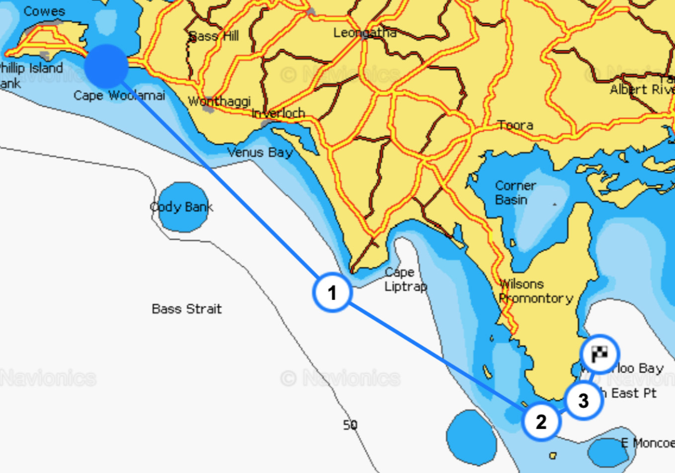
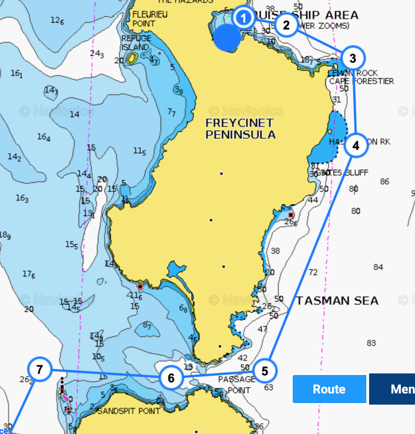
Cleeland Bight provides a safe anchorage under the protection of Cape Woolamai on Phillip Island. There are 2 public moorings close to the beach in under 2 metres but I chose to anchor 200 metres south of these in 2.5 metres just behind a protecting sand bank. Refuge Cove is a 12 hour sail from there so a dawn departure is recommended.

Cleeland Bight – Refuge Cove (March 1)

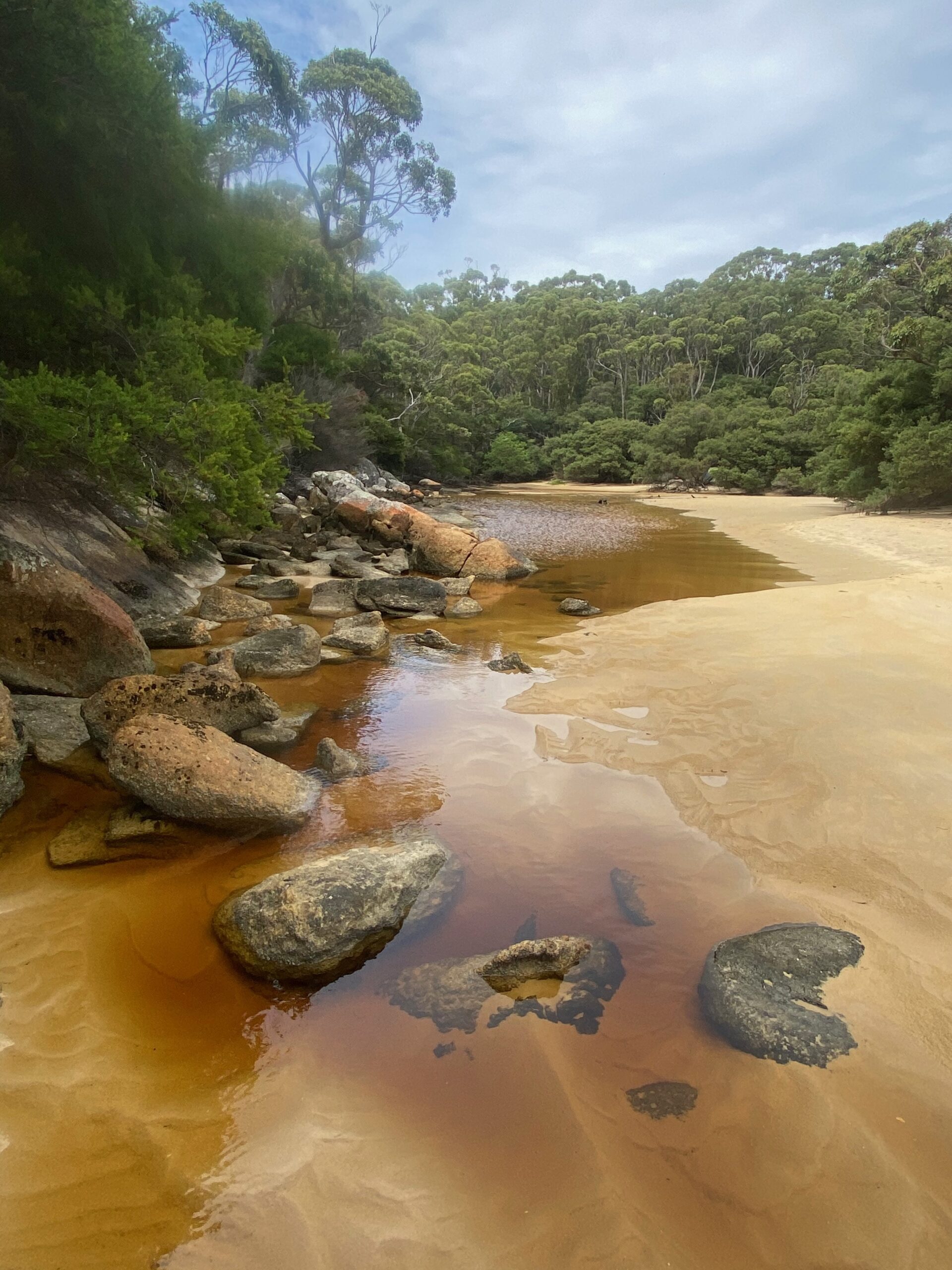
The SW winds were light but as forecast came up mid-morning and we made good speed to drop anchor in Refuge Cove just after 4pm.

We stayed two nights resting, bathing, sightseeing and fishing before heading off across Bass Straight to Flinders Island via Deal Island.

I met a cruising couple on the beach at Refuge and joined them for a drink on their 42′ yacht. They very kindly gave me some sea-sickness medication for Yvette who had been unable to shake off her sea-sickness when sailing in Bass straight’s heavy swell.

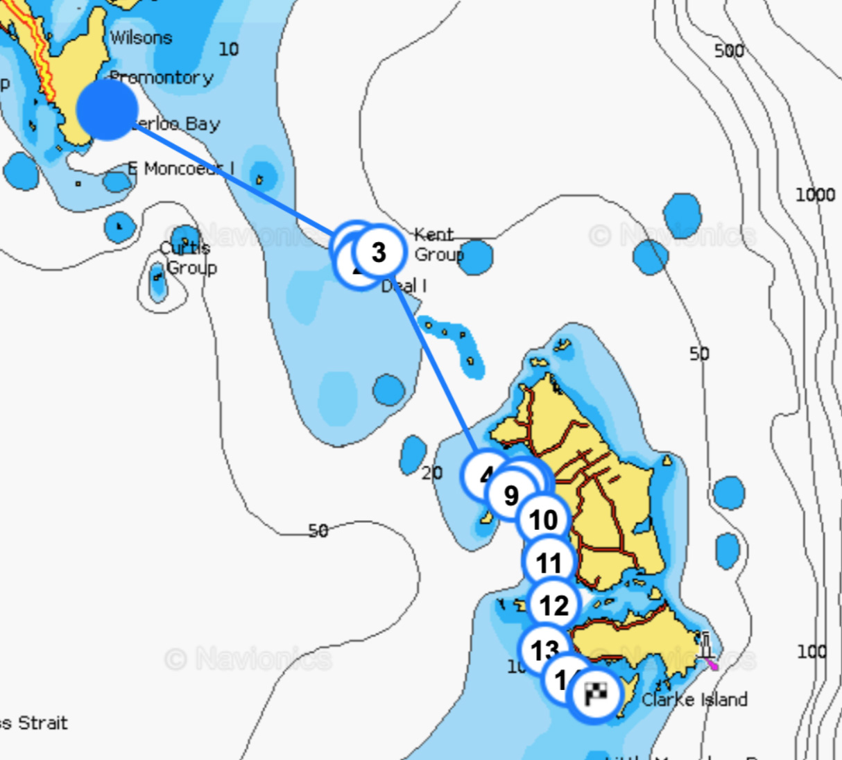
Refuge Cove – Deal island – Flinders Island – Clarke Is (March 3-5)

The forecast of a 25-30 knot SW winds made for an ideal crossing both days. Leaving from Refuge at dawn, Our Tommy made over 8 knots to Deal island and 7 knots to Flinders Island on the second day for a fast and safe Bass Straight crossing – my first!

It was windy, overcast and cold on Deal Island so we decided not to explore but press on to Flinders Island after sheltering in Garden Cove overnight. On arrival the changing easterly conditions suggested taking up a MAST mooring for an overnight stay in beautiful and secluded Port Davies (pictured).

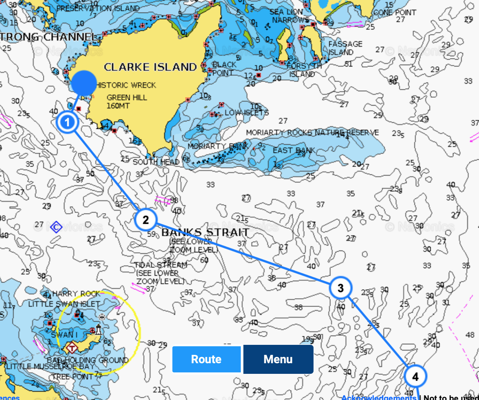
The strong easterly winds moved us quickly south the next day. We knew heavy weather was forecast in a few days for Banks Straight so we decided to press on to Spike Cove in Clarke Island and hope for a favourable weather window the next day to cross over to Tasmania.

I kept in mind the old fisherman’s warning:

“So you have crossed big mean Bass Strait and think you are all done. But then you start going across Banks Strait and get a slap on the backside, just to remind you who is boss. Don’t relax too early!” 

Clarke Is – Binalong Bay via St Helen’s Is (March 7-8)

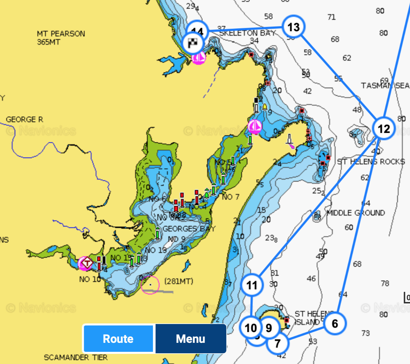
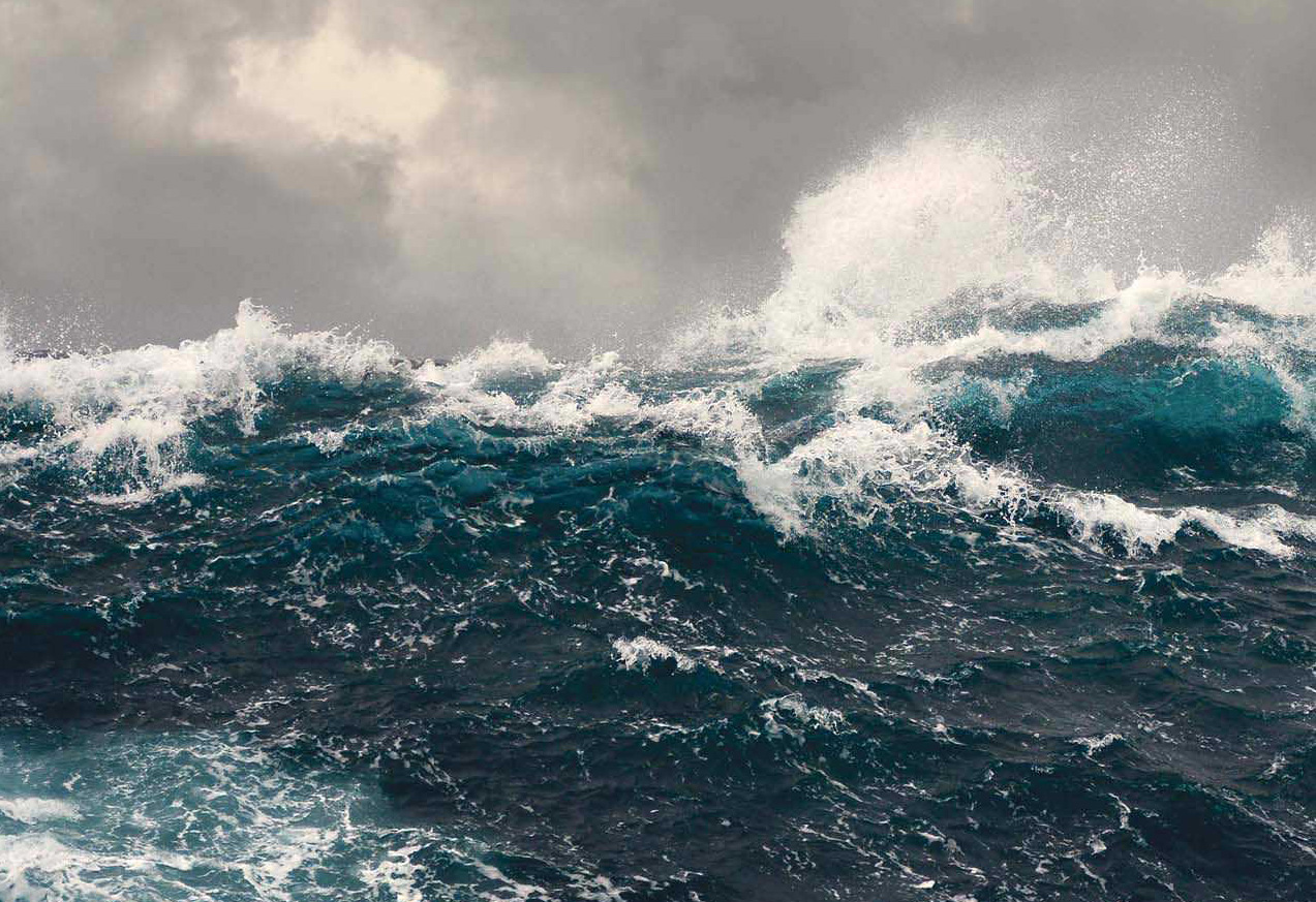
The weather forecast was for 20-25 knot NE winds all day. Leaving just before dawn gave us the tide assist in Banks Straight but as the wind quickly blew up to 30-35 knots (gusting to 40 knots!) the wind against tide conditions made for very large choppy seas and seriously uncomfortable conditions.

The crew were understandably fearful, never having experienced seas of this magnitude, but I knew that Our Tommy was built to survive much worse conditions. Nevertheless, holding course proved challenging but Ludvik’s strength and fitness allowed him to take the wheelhouse helm most of the day. When we finally turned southwards the following swells were well over 4 metres and constant attention to the course and helm were required.

Late in the afternoon, as we neared Binalong Bay and our intended MAST mooring, I realised the northerly conditions were not suitable for a bay exposed to the north. Instead we sailed on for two hours to our alternate anchorage behind small St Helen’s Island which provided us with a protection in 12 metres of water off a rocky shore. We dropped the hook at 8.30pm after 16 hours of arduous sailing. It wasn’t ideal but we were safe – and I carefully monitored the anchor overnight.

Binalong Bay – Wineglass Bay (March 9)

The strong northerlies had abated by the morning but the crew were unhappy with the sailing conditions and made their excuses so as to leave the boat as soon as we could sail to Binelong Bay. Yvette had been unable to shake her sea-sickness and had never become conditioned to big ocean swells.

By 10.30 am we picked up a MAST mooring at Binalong Bay and I ferried the crew ashore to catch a bus to the airport. They did a great job helping me across both Bass and Bank Straights but an unhappy crew does not make for a happy boat. It was good to be alone with Our Tommy.

I stayed three nights in the bay just near the township of St Helens. I tried to no avail to get apilot to guide me through the river bar into town but in the end a friend-of-a-friend who lives in St Helen’s picked me up at the boat ramp (picture below) and drove me into town for supplies.

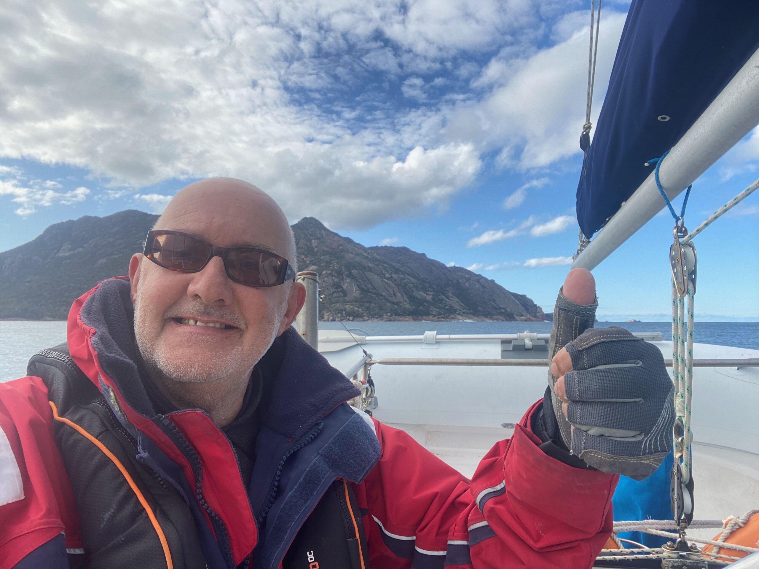
Having never done it before, I was nervous about single-handing Our Tommy but after a few days the winds abated and I motored south to the protection of magnificent Wineglass Bay.

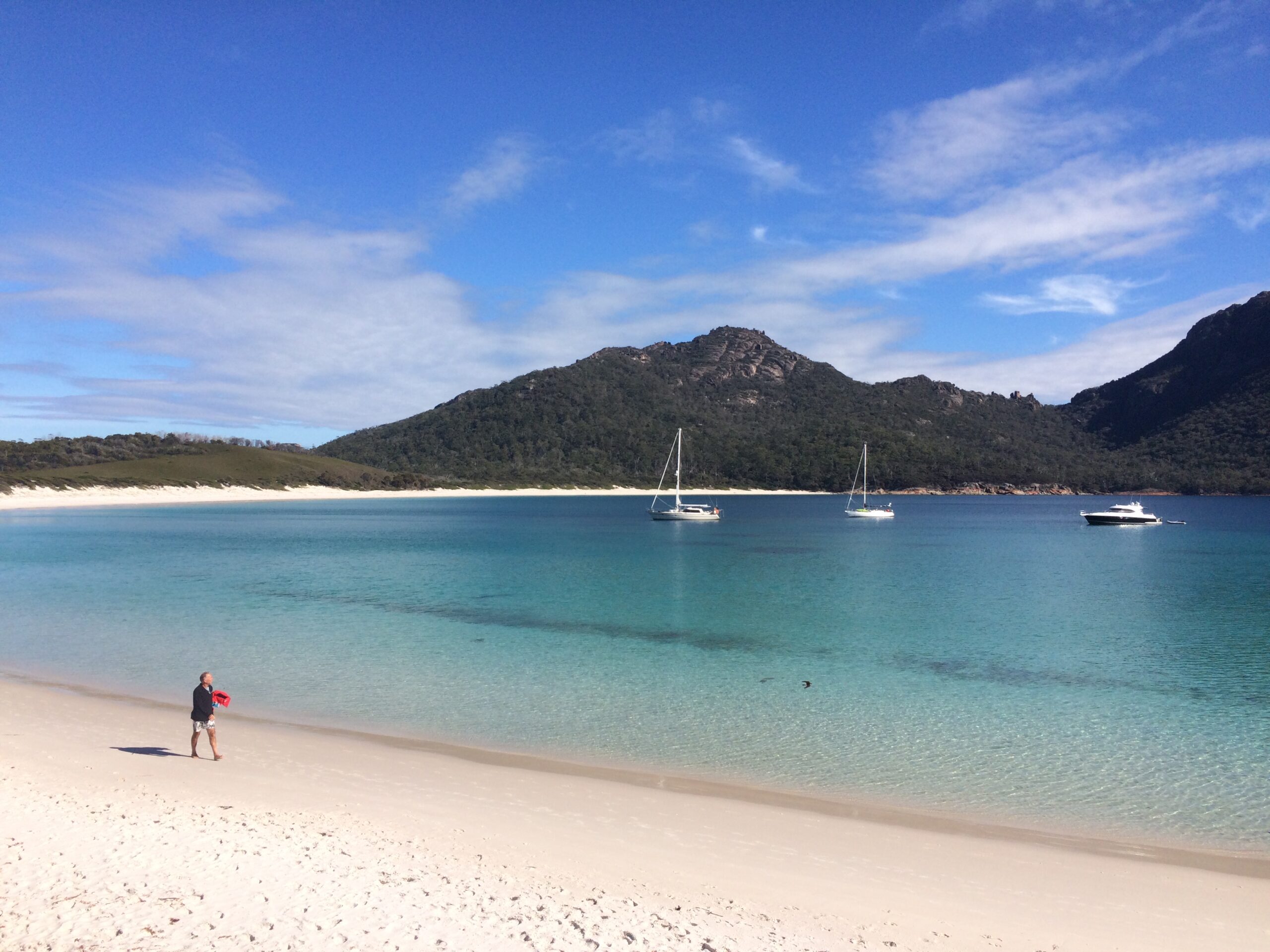
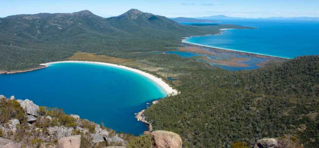
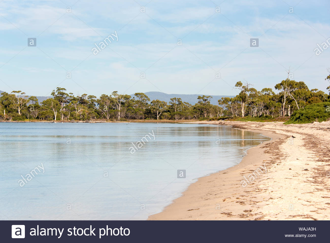
Wineglass Bay is a stunning as everyone says it is, although I’d take Refuge Cove any day. That evening I felt pleased that I had successfully single-handed Our Tommy for the first time.

Photo of Wineglass Bay anchorage courtesy of MAST Tasmania.

Wineglass Bay – Maria Island (March 12)

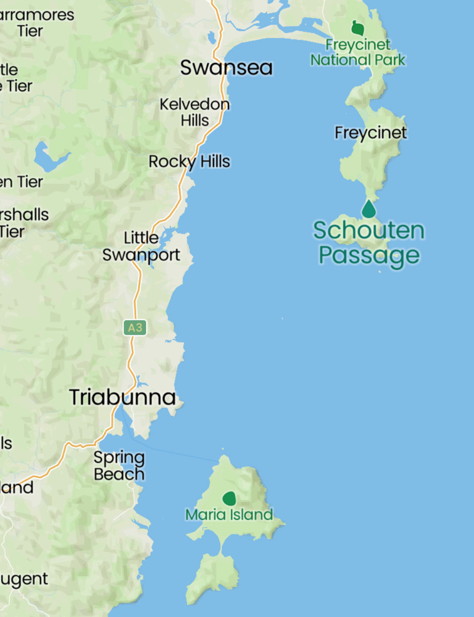
After Wineglass Bay I said farewell to the heavy Tasman Sea and found shelter behind the Schouten Passage.

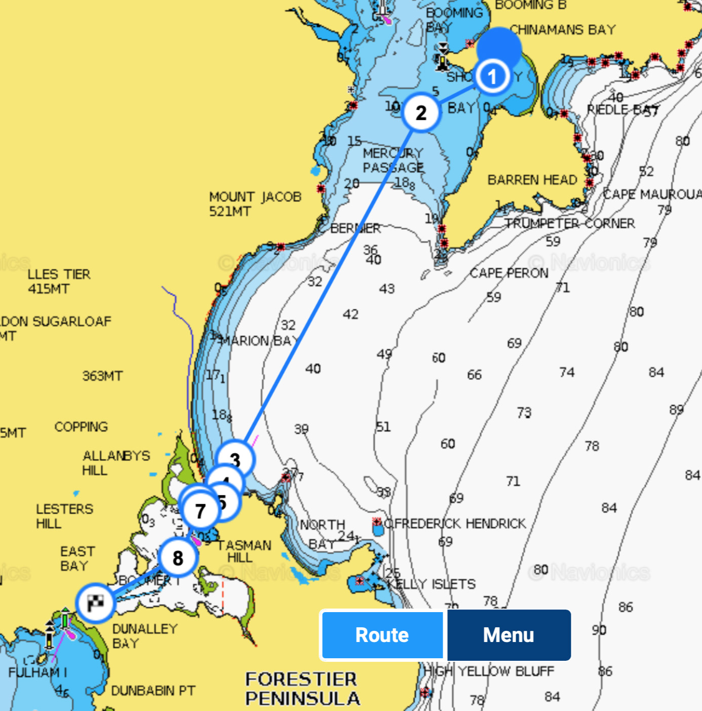
My destination was Maria Island, a lazy day-sail beyond the Shouten Passage just south of Wineglass Bay. I was also looking forward to sharing an anchorage with Rich Cowling and Michele Sly who were sailing north from Kettering, and who were renting me their berth at Oyster Cove Marina.

I made VHF radio contact with Michele a few hours north of Maria Island and we agreed that an anchorage in Chinaman’s Bay in the north of Shoal Bay was best for the conditions. It was as flat as a pancake and our boats barely moved that night.

Maria Island – Dunalley/Denison Canal – Kettering (March 13-14)

Fifteen days after leaving home and this is the home straight – just a half day-sail to Dunalley and the northern end of the Denison Canal. The MAST information for Denison Canal, especially the accurate and downloadable up-to-date routes are an essential study – I would NOT navigate these shallow waters without their routes installed on my chartplotter.

Then, after overnighting on a MAST mooring at Dunalley I waited for my 11am pre-arranged transit of the canal before an easy half day-sail to our new home in the Oyster Bay Marina in Kettering – Cheers!

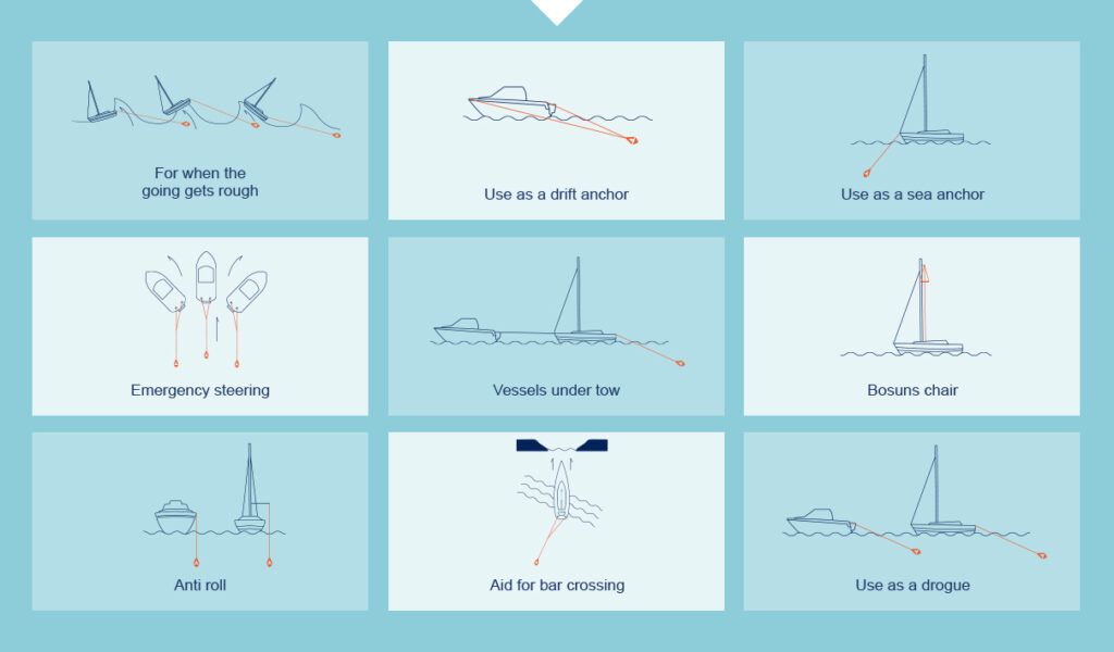
SeaBrake – when a conventional drogue and sea anchor just won’t cut it

Our Tommy has a Seabrake to assist in times of need. Born out of necessity in a life and death situation in Australia’s notorious Bass Strait, Captain John Abernethy conceived the Seabrake principle when conventional drogues and sea anchors failed.

Most importantly it can assist with control and safety in heavy seas or when crossing a river bar but, as this diagram shows, it has many other uses as well.

Seabrake, now owned by Burke Marine, is approved by the Australian Maritime Safety Authority as a sea anchor: Solas certificate #4126 and is compliant with the AYF as an emergency steering device.

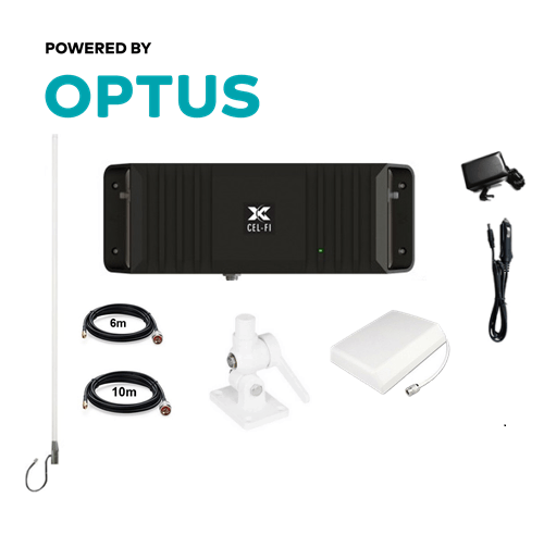
CEL-FI GO2 OPTUS MARINE PACK

Last year I purchased the Cel-Fi GO2 Smart Repeater marine pack for Optus to boost mobile signals on board.

Due to time constraints I haven’t installed it yet but I’m hopeful it will be useful when I’m cruising. It would have been very useful at Refuge Cove where there was no coverage unless you climbed the hill.

I’ll post a review once it’s installed and operational.

Young Tommy – SIROCCO Alloy 2.4m RIB

Young Tommy, Our Tommy’s SIROCCO Alloy 2.4m RIB tender, offers the benefits of a completely flat cockpit floor, with the weight saving and strength of an aluminium hull.  Made from ORCA® Hypalon, it features large diameter tubes, stainless steel towing eyes (tubes), welded lifting points, pinned oar row locks, extra heavy transom, and multiple buoyancy chambers.   

Hypalon RIBs stand up well to UV light, and Young Tommy can be stored either on the aft davits or secured to the foredeck for open water cruises.

B&G electronics suite

Our Tommy was refitted in 2019 with a range of B&G electronics:

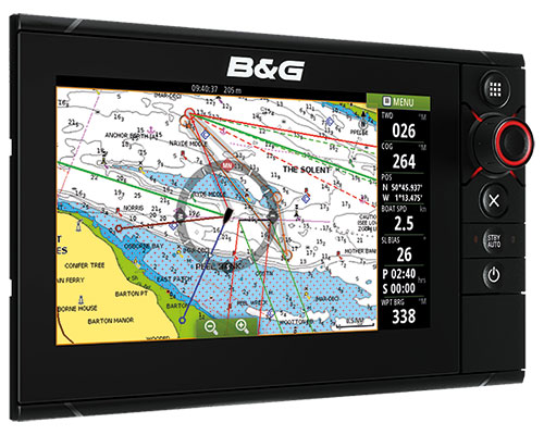
Zeus³ 9 chart plotter

The Zeus³ 9 fitted a navpod at the aft helm is a complete chartplotter navigation system designed for blue water cruisers. The ultra-bright, wide-angle display combines an all-weather 9-inch touchscreen with a rotary dial and keypad for ultimate control in all conditions. Sailing features include SailSteer, Laylines, and RacePanel. Its built-in Wi-Fi connects with online services and my iPad and integrates seamlessly with the B&G AIS/DSC VHF, Triton display and forward seeking sonar. It also integrates with Our Tommy’s autopilot and PredictWind.

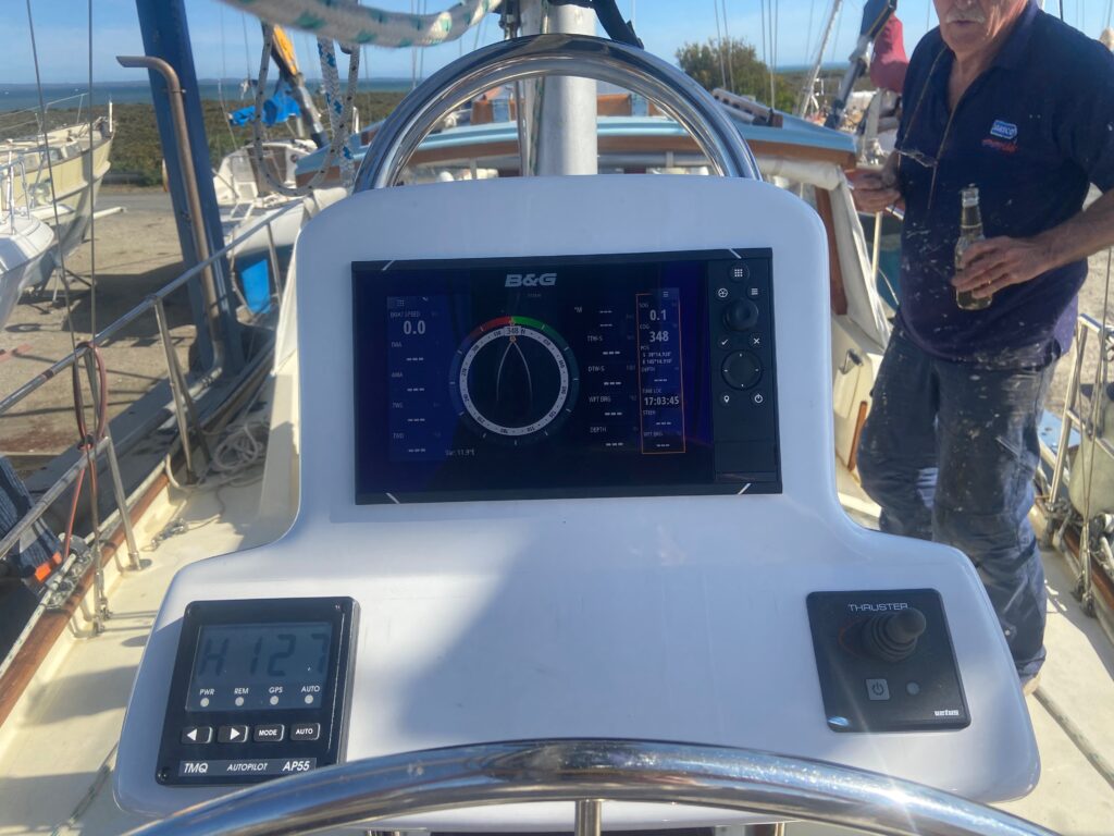
Our Tommy’s Navpod at the aft helm with the TMQ autopilot (left) and bow thruster controls (right)

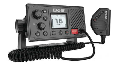
Zeus³ V60-B VHF Marine Radio, DSC, AIS RX/TX

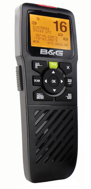
Features a built-in GPS and a full Class B AIS transmitter and receiver, which allows Our Tommy to see and be seen by nearby AIS-equipped vessels and her 3 rescueME MOB1 beacons fitted to the lifejackets.

This radio integrates with the portable wireless handset mounted in the wheelhouse (right).

Triton² Digital display

Our Tommy’s Triton² Digital display is mounted in the wheelhouse and has a 4.1-inch colour screen, optically bonded for zero condensation and featuring trans-flective LCD technology for exceptional contrast and visibility in all lighting conditions. It connects the entire electronic suite via Our Tommy’s NMEA2000 backbone.

ForwardScan Long Stem Transducer

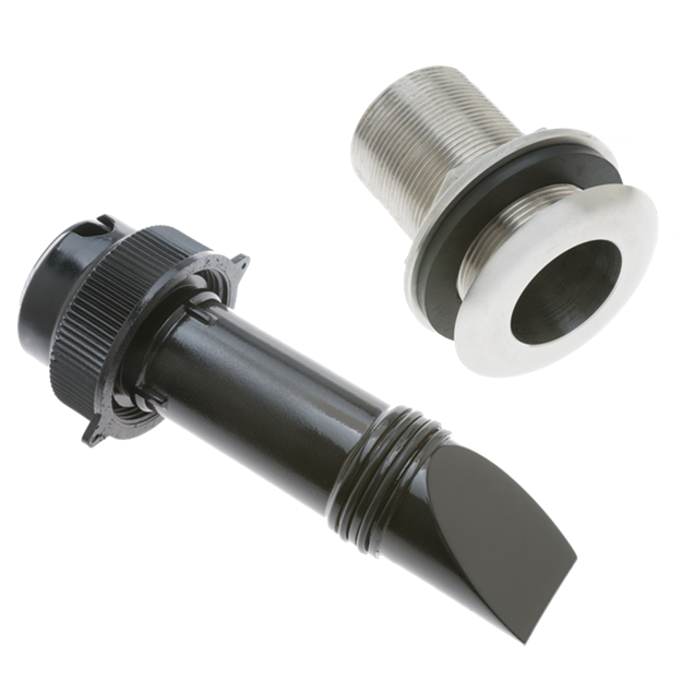
Our Tommy’s ForwardScan sonar allows her skipper to know what lies ahead by displaying on the Zeus³ 9 a clear two-dimensional image of the bottom in front of the vessel thus allowing me to navigate shallow or poorly-charted waters with confidence. It has real-time updates and a forward-looking view of up to eight times your current depth.

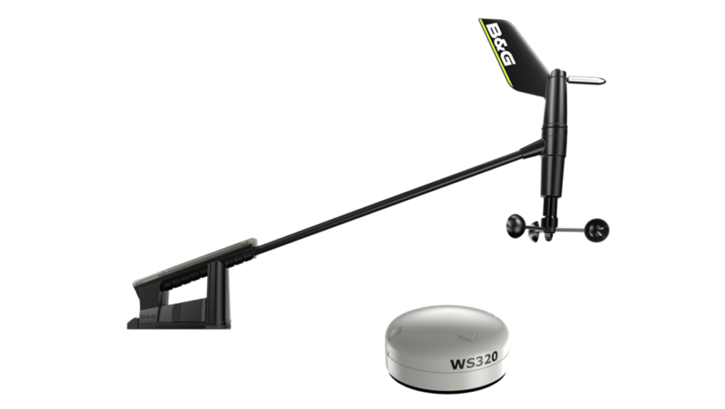
WS320 Wireless Wind Pack

This high precision wireless wind sensor, mounted atop the main, provides exceptional data accuracy and aerodynamics.

WP2Social Auto Publish Powered By : XYZScripts.com